Peter Walsh (Rathinure Names)
“The Enduring Names of Rathinure” (2020) by Peter Walsh, of Rathinure, Glenmore.
Shorter version of this article was published in Glenmore Times: Millennium Memories (2000).
The word Rathinure, (or Rathnewre Parish as Sir William Petty recorded on the Down Survey Map 1656-1658), simply means rath or ring fort, i.e. fortress of the yew trees. The raths or ring forts were the dwelling places of the early farmers. The raths were circular enclosures that were in use from the Bronze Age (2,000 to 500 B.C.) until about 100 A.D. As one would expect the village of Rathinure sprang up not far from a rath. The ruins, of the only rath known to have been located in the townland of Rathinure, were located in a field called the Milleas. However, the few remaining old meandering field ditches in the fields of the Ocht Na Grainsí suggest that the ditches were once part of large circular enclosures or raths.
From the earliest Glenmore church records the Kennedy name was associated with Rathinure. The name flourished and various records and oral traditions indicate that at one time seven different families of Kannedy made Rathinure their home. To distinguish the various Kennedy families of Rathinure nicknames developed. These names included: the Pierces, Bills, Faddies or Paddies, Michilins, Sean Ógs, John (the Wall) and John (Khosub) who is believed to be Jack “the Leg” Kennedy due to his height. In 2000 although many residents of Rathinure were related to one or more of these seven families, Larry Kennedy (of the Faddie Kennedys) was the last Kennedy born, raised and to have remained in Rathinure farming with his brothers on the family farm. Just prior to 2000 Larry Kennedy went to live in a retirement home in Waterford, and for the first time since at least the mid 1700’s there was no person named Kennedy residing in Rathinure.
From all indications farming has been a sustainable way of life in Rathinure for centuries. Although the population of the parish of Glenmore declined significantly after the Great Famine, the 1881 census reveals that Rathinure had 26 inhabited dwelling houses with 182 inhabitants. At the turn of the 20th century there were approximately 11 farms in the townland of 575 acres. In 1950 the following farms were in operation in Rathinure: (1) Faddie Kennedy’s; (2) Walsh’s (Pierce Kennedy); (3) Kehoe’s; (4) Sean Óg Kennedy’s (now Garvey’s); (5) Johnny Roche’s (now Michael John Roche) and (6) Ned Roche’s (now Michael Pat Roche). Fifty years later on the brink of the 21st century it was noted that the townland was almost deserted with only 5 farms in operation. There were about 11 inhabited dwelling houses with approximately 33 inhabitants in the townland. Many of the family names long associated with the townland had disappeared such as the Walls, Hogans, Quinns, Delahuntys and Kennedys.
The farms around Rathinure are unusual for Kilkenny in that the land in each farm is not contiguous. It appears that when the townland was divided each farmer received parts of the best and worst land. This system is usually referred to as rundle and is a common practice in the west of Ireland. It is not known whether the rundle system from the west was brought to Rathinure, or this practice of sharing the good and bad land is an ancient custom in Rathinure. There are three primary boreens (lanes) that connect the various fields of the Rathinure farms. The Boosheen Fada (long lane) lives up to its name as it is nearly a mile and a half in length running from the High Road to Rathinure parallel to and higher than the Rathinure Road. Off of the Boosheen Fada is the Boosheen Gearr (short lane) of less than 150 yards in length that links three fields to the Boosheen Fada. The third lane is the Church Lane (Kilcolumb Lane) that runs from the Rathinure Road at the west side of Rathinure Village running for nearly half a mile to a fork. The left fork goes to the railway and the right fork passes the ruins of Kilcolumb Church to intersect with the lane that runs from the High Road to Scart. Rathinure is also unusual because there were only two known evictions. The Paddy Roche’s of Scart were evicted from a field they had in Rathinure sometime before the turn of the 20th century.
The following fields are scattered around the townland of Rathinure and the names of these fields have been passed from one generation to another. Where possible interpretations and explanations are provided.
Bán Riach—Irish for a grey/white fallow field. A fallow field is one that is not plowed or cultivated to allow the soil to regenerate. This field is off of the Church Lane and is owned by Niall Clarridge, of Grogan.
Garrai Glas—Irish for a green field. A small field on the Rathinure Road owned by Peter Walsh of Rathinure.
Gorrt na Sidheog—Irish for the fairies’ field which is said to derive from a tradition of losing ones way at night. This field is located on the Church Lane.
Ocht na Grainsí—Originally thought to be Irish for the field of the ugly fairy. However, a WIT historian and archaeologist determined that grainsí described a granary that existed in these fields until medieval times. These fields are now owned by Nicholas Kelly, of Aylwardstown.
Mointáin—Irish for a low-lying swampy land. The Rathinure Mointáin is a small area if approximately one half of an acre located along the Rathinure road that runs from the High Road to what was once the Village of Rathinure. The Mointáin was a small swallow pond where livestock were watered until the 1970’s. It was very shallow and annually had to be dredged. During cold weather children in Rathinure enjoyed sliding on the ice covered pond. Today the pond has been filled in.
Moineans—is Irish meaning an extensive commons area. It is believed that this may have been the location of the old Rathinure school, Tom Haberlin’s forge and the Manning’s house.
Sceath a Nach— is Irish for a field of hawthorns or sceachs. Today the name of this field is pronounced Ska-hara. This field belongs to Peter Walsh of Rathinure and is located at the end of the Boosheen Gearr.
Sean-bheitin—This Irish phrase describes a farming method of cultivation that was more destructive than beneficial. The earth was skinned, then piled and burned. Potatoes would then be planted. This practice was abandoned, but the name survived. This field belongs to Peter Walsh of Rathinure and is located on the High Road behind Kathleen O’Connor’s house.
Siléans—today these fields are pronounced “shell hawn” by the Rathinure residents. The Irish word means rivulets or drains. These fields belong to Nicholas Garvey, of Rathinure and are located on the road from Rathinure to Ballylogue (Rochestown).
Portnulach—Irish for area of apples. This field is located just below the old Pierce Kennedy dwellinghouse on the southeast edge of the old Village of Rathinure and is believed that it once contained the cottage of Jack the Leg Kennedy and an orchard. This field belongs to Peter Walsh, of Rathinure.
Seuchar Bhfola—today pronounced “scrua bhula” Modern Irish dictionaries were of no assistance with these words, but thanks to Danny Dowling and his 1817 Irish Dictionary by Edward O’Reily, it was discovered that Seuchar was an old Irish word meaning “brambles used against cattle.” It is surmised that the brambles were fencing and blood red in colour hence the word fola or blood. The Seuchar Bhfola is located one field in from the High Road on the north (upper) side of the Boosheen Fada lane. The field belongs to Peter Walsh, of Rathinure.
Srath lia Mhor—today pronounced “strallyboore,”. The Irish for this phrase is big grey fern. This field is located on the bend of the Boosheen Fada lane and belongs to Peter Walsh, of Rathinure.
Gort na Locha—is Irish for a cultivated field with lochs or little ponds. Located on Church Lane at the fork and belongs to Peter Walsh, of Rathinure.
Ni Deach—the meaning of this field is unknown. This field is located on the High Road north of the Boosheen Fada lane. It was part of the Faddie Kennedy farm and now belongs to Gerry Dowling, of Carriganura, Slieverue.
Cuth na Cré—One possible meaning is that the field contained a skein or thread of clay. Part of the Faddie Kennedy farm, it bounces the Seuchar Bhfola. Cuth na Cré is now owned by Nicholas Kelly, of Aylwardstown.
Garrai Dioch—meaning unknown. Field on the Rathinure Road where the Walsh bungalow is located.
Scalaige—meaning unknown. Two fields bear this name and are located off of the left fork of the Church Lane. The large Scaliage is owned by Nicholas Garvey, of Rathinure, and the small Scailiage is owned by Michael Pat Roche of Rathinure.
Barrol Óges—one possible suggested meaning is dara óges or young oaks. This field is accessed from the Siléans field and is owned by Nicholas Garvey, of Rathinure.
The Race Course—two identical long, narrow strips of fields where point to point racing was held by the Phelans, of Ballyhobuck, in the late 19th century. These Phelans occupied the present farm owned by the Walsh family of Ballyhobuck, Glenmore. The finish line was the faiseach, which is near the boundary of Nicky Walsh’s Gleb field. (Nicky Walsh, of Grogan, Davisdstown, Glenmore died in 2015 at the age of 95 and the field is now owned by his grand-nephew Niall Claridge of Grogan).
The Football Field—is probably the most level field in Rathinure. It is known that football was practiced in this field during the early years of the 20th century by such notable players as Stephen Heffernan, of Aylwardstown; Ned Roche, of Rathinure; Watty Walsh of Rochestown; and Jimmy Walsh of Rochestown. The field is accessed from the Church Lane and owned by Nicholas Garvey of Rathinure.
Byrne’s Hill—No record has been discovered of any person named Byrne to be associated with this field, yet the name endures. The remains of an old haggard are still in the field. Danny Dowling believes that Wattie Power’s mother was born and raised in a small bothán (house) located in the haggard in this field. (Wattie Power, of Jamestown, per Danny Dowling Wattie’s father was the last native Irish speaker of Glenmore). Byrne’s Hill is located on the Rathinure Road, across from Peter Walsh’s milking parlour and is owned by Peter Walsh.
The Milleas—these fields derive their name from Fr. Millea who built a house in Rathinure. According to Danny Dowling, Father Thomas Millea was the parish priest in Slieverue from early in 1784 to July 1791. At this time Glenmore was part of the parish of Slieverue. Although Father Millea died before 1800 the land he occupied still bears his name. These fields are owned by Michael John Roche, of Rathinure.
The Mass Path—this field today belongs to Peter Walsh and with its stiles served as a mass path or short cut for the people of Rathinure and Rochestown to walk to mass in Glenmore. It was in use until the late 1950’s or early 1960’s by older residents.
Clearys—There were two fields on the High Road that bore this name, but it is not known how these field came to be named. These fields are at the entrance to the Boosheen Fada lane from the High Road. Pat Doherty, of Haggard, now has these fields and made the two fields into one.
The Three Fields—this field once accurately described an area of over ten acres in Rathinure. Later some of the ditches were removed and the area became two fields. Today, like so many other Irish fields all internal ditches have been removed. However, unlike most other fields it has acquired an ordinance survey marker, denoting it as the second highest point in Glenmore. These fields were once part of the land farmed by the Walls, of Rathinure, before their eviction. Today, the fields are owned by Nicholas Kelly, of Aylwardstown.
Talamh an Gabha—today this is pronounced Talagow. The phrase is Irish for field of the blacksmith. (This field may be in Ballyhobuck rather than Rathinure.) This field is owned by Walsh’s of Ballyhobuck and is located on the High Road.
Johnny-Paddie’s Field—named for Patsy-Paddie’s father Johnny-Paddie Roche. Patsy Paddie Roche, of Scart, Glenmore was an uncle of the Forristal’s of Glenmore Village. The Roche’s were evicted out of the field. Originally before the internal ditches were removed there was more than one field and there was a one room botháin (house) in the corner of the eastern edge of the field. Today the field is owned by Nicholas Kelly, of Aylwardstown. The name of this field was passed from Paddy Kennedy (of the Faddie Kennedy’s ) to Peter Walsh, of Rathinure.
Páirc Fáda—this is Irish for the long field. This field is located on the High Road, across from the Boosheen Fada lane. This field belongs to Peter Walsh, of Rathinure.
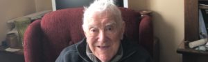
The author, Peter Walsh (1953– ) is a lifelong resident of Rathinure, Glenmore and is a descendent of Pierce Kennedy.